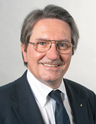
Prof. Dr. Thomas A. Wunderlich
Academic Career and Research Areas
Prof. Wunderlich’s (b. 1955) research focuses on the development and application of geodetic methods for high-precision measurement in construction and industrial production. He uses geometry to gain insight into complex problems. This applies to all three processes: recording (geodetic surveying using navigation satellites, as-built surveying with terrestrial laser scanning), setting out (building machinery guidance with intelligent tachymeters) and monitoring (automated deformation monitoring of buildings, production plants and mass movements to minimize risks).
After studying geodesy at TU Vienna, he did his doctorate there in 1983. He completed his postdoctoral teaching qualification (habilitation) in 1992 at the University of Hannover after receiving an Alexander von Humboldt grant to study there (1987/88). His first professorship was associate professor of applied geodesy in Vienna. He then succeeded K. Schnädelbach at TUM’s Chair of Geodesy in 2000. Wunderlich was Permanent Secretary of the German Geodetic Commission (DGK) (2008-2015) at the Bavarian Academy of Sciences and he is a member of the Austrian Geodetic Commission.
Awards
- GeodäTUM Prize for excellent teaching (2017, 2011, 2010, 2009) and teaching prize „goldene Lehre“ of the FSLRG (2020)
- Award of the Soldner Medal of the Bavarian State Ministry of Finance, Land Development & Homeland (2019)
- Gold medal of honor "For a more equitable world" of the Munich Society of Land Management and Land Tenure (2012)
- Honorary Professor, Universitatea Politehnica Timisoara (2010)
- Friedrich Hopfner Medal, Austrian Geodetic Commission (2002)
Key Publications
Wasmeier P, Reith C, Wiedemann W, Wunderlich T, Chmelina C: “IMU based orientation transfer at Semmering base tunnel”. Journal of Geodesy. 2018 (in review).
Zhou Y, Wagner A, Wunderlich T, Wasmeier P: “Calibration Method for IATS and Application in Multi-Target Monitoring Using Coded Targets”. Journal of Applied Geodesy. 2017; 11(2): 99-106.
Wunderlich T, Niemeier W, Wujanz D, Holst C, Neitzel F, Kuhlmann H: “Areal Deformation from TLS Point Clouds – the Challenge”. Allgemeine Vermessungs-Nachrichten. 2016; 123(12): 340-351.
Ge X, Wunderlich T: “Surface-based matching of 3D point clouds with variable coordinates in source and target system”. ISPRS Journal of Photogrammetry and Remote Sensing. 2016; 111(1): 1-12.
Thuro K, Wunderlich T, Heunecke O, Singer J, Wasmeier P, Schuhbäck S, Festl J, Reith C, Glabsch J: „Low cost 3D early warning sytem for instable alpine slopes – the Aggenalm Landslide monitoring system”. In: Early Warning for Geological Disasters. Editors : Wenzel F, Zschau J. 2014; Springer: 289-306.
If you wish your profile to be changed or updated please contact Franz Langer.